- Date: 7/7/12
- Route: Northwest Ridge
- Distance: 11 miles
- Elevation Gain: 4,500 feet
- Summit Elevation: 14,197 feet (Belford) 14,153 feet (Oxford)
- Start: 7:15 a.m.
- Summit: 9:30 a.m. (Belford) 10:30 a.m. (Oxford)
- Out: Northwest Ridge
- Difficulty: Class 2
- Conditions: Poor (Rain)

This past weekend I headed for the Collegiate Peaks with my wife to do a bit of backpacking and hike a couple 14ers.
Friday we drove through Leadville and headed south on U.S. 24 to Chaffee County 390 road where we headed west to the trailhead for Mount Belford.
We loaded up the packs and headed in, the plan was to camp near treeline and then summit Belford and Oxford on Saturday.

While it was only about a mile and a half hike to treeline, it was really steep and the packs didn’t make it any easier. On top of that it rained much of the way in.
The trail starts with steep switchbacks up the mountain until it levels off slightly heading up the valley. The trail crosses the river in Missouri Gulch and climbs again on a rocky trail towards treeline.

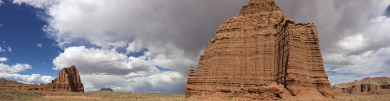
Eventually we came up on an old broken down log cabin where Belford comes into clear view. It was here we pitched camp for the night. We had a brief window of clear sunny skies where we filtered water in the stream and cooked dinner before the rain clouds moved in.
We retreated to the tent where is rained non-stop all night long. We had planned to start climbing at 5 a.m., but when the alarm when off and it was still raining we went back to sleep.

Around 7 a.m. the rain let up and we started hiking. Since we had backpacked in it was only a couple miles to Belford’s summit, but there was nearly 3,000 feet in elevation gain in that distance.
The trail meandered through an alpine meadow before coming to a fork in the trail. To the right is Missouri and the left Belford. I headed left, crossed a stream and started the climb.

After a steep rocky section, the trail switchbacks up the ridge and includes two false summits. The first one I saw coming, but the second one fooled me. As I climbed, clouds rolled up the valley and by the time I reached the summit I was in the clouds.
I paused on the summit and snapped a photo of me in the soup and then headed on towards Oxford. As I descended Belford I knew it was going to hurt to hike back over.

The saddle between the two peaks was shrouded in clouds and was pretty mellow. I got a few clear glimpses of the valley floor below. The climb up Oxford was fairly easy minus one false summit.
Again, the summit of Oxford was covered in clouds and the wind picked up a bit. I paused to sign the trail register and grab a snack before heading back towards Belford. The climb back up Belford was really steep and slick from the rains.

When I rested the ridge I could see my wife waiting on the summit of Belford for me. I scrambled back up to the top of Belford where the first clap of thunder struck. Until now it had just been cloudy and rainy, but as we started back down the skies opened up.

It started hailing, thundering and lightning. We picked up the pace, but it was tough to go too fast because the rocks were slick.
Soon we made it back to camp and jumped in the tent to warm up. Everything was soaking wet at this point.
Originally I had planned to stay the night and hike Missouri the next day, but being cold wet and hungry we opted to pack it on out and save the third 14er for a dry day.
